
File:Jame'Asr Hassanil Bolkiah Mosque (18565560896).jpg

Size of this preview: 800 × 532 pixels. Other resolutions: 320 × 213 pixels | 5,491 × 3,653 pixels.
Original file (5,491 × 3,653 pixels, file size: 3.5 MB, MIME type: image/jpeg)
Summary
| Description |
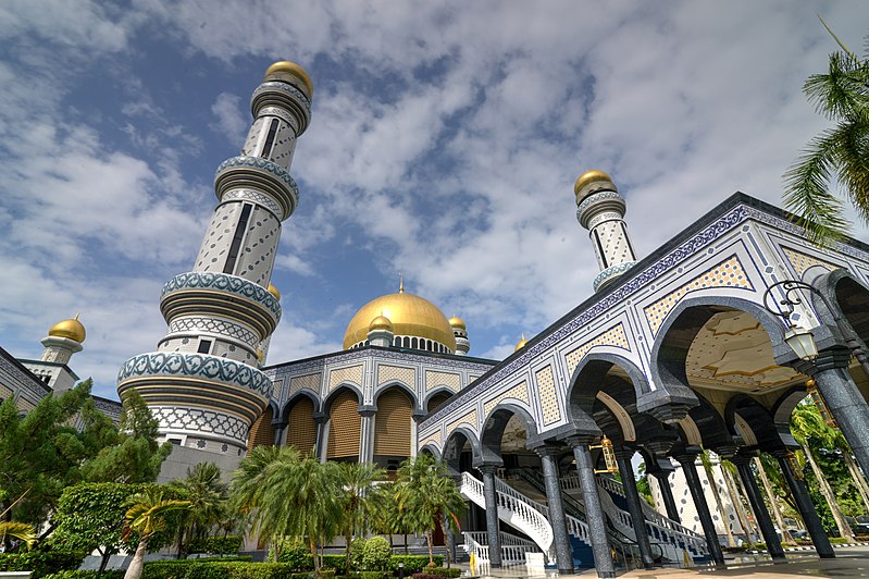
English: Jame'Asr Hassanil Bolkiah Mosque is a magnificent Masjid built to commemorate the 25th anniversary of the current Sultan of Brunei in 1994 (Sultan Haji Hassanal Bolkiah Mu'izzaddin Waddaulah). It is the largest in Brunei and one of the grandest in the region. With its golden domes, it is the centerpiece of Brunei's Islamic heritage.
It is located in a huge complex with beautifully kept gardens. Inside the Masjid, it is intricately decorated [crescentrating.com] |
| Date | |
| Source | Jame'Asr Hassanil Bolkiah Mosque |
| Author | Jorge Láscar from Melbourne, Australia |
| Camera location | | View this and other nearby images on: OpenStreetMap |
|---|
.jpg¶ms=004.898447_N_0114.922038_E_globe:Earth_type:camera_source:Flickr_&language=en)
Licensing
- Object
|
Freedom of panorama is granted by Section 66 of the Emergency (Copyright) Order, 1999:
|
- Photograph
This file is licensed under the Creative Commons Attribution 2.0 Generic license.
- You are free:
- to share – to copy, distribute and transmit the work
- to remix – to adapt the work
- Under the following conditions:
- attribution – You must give appropriate credit, provide a link to the license, and indicate if changes were made. You may do so in any reasonable manner, but not in any way that suggests the licensor endorses you or your use.
| This image was originally posted to Flickr by Jorge Lascar at https://flickr.com/photos/8721758@N06/18565560896 (archive). It was reviewed on 2 February 2018 by FlickreviewR 2 and was confirmed to be licensed under the terms of the cc-by-2.0. |
File history
Click on a date/time to view the file as it appeared at that time.
| Date/Time | Thumbnail | Dimensions | User | Comment | |
|---|---|---|---|---|---|
| current | 13:22, 2 February 2018 | | 5,491 × 3,653 (3.5 MB) | Thesupermat2 | Transferred from Flickr via Flickr2Commons |
File usage
The following page uses this file:
.jpg)