
File:Upper Castle in Vilnius (9651324175).jpg
Size of this preview: 800 × 600 pixels. Other resolutions: 320 × 240 pixels | 4,000 × 3,000 pixels.
Original file (4,000 × 3,000 pixels, file size: 2.63 MB, MIME type: image/jpeg)
Summary
| Description |
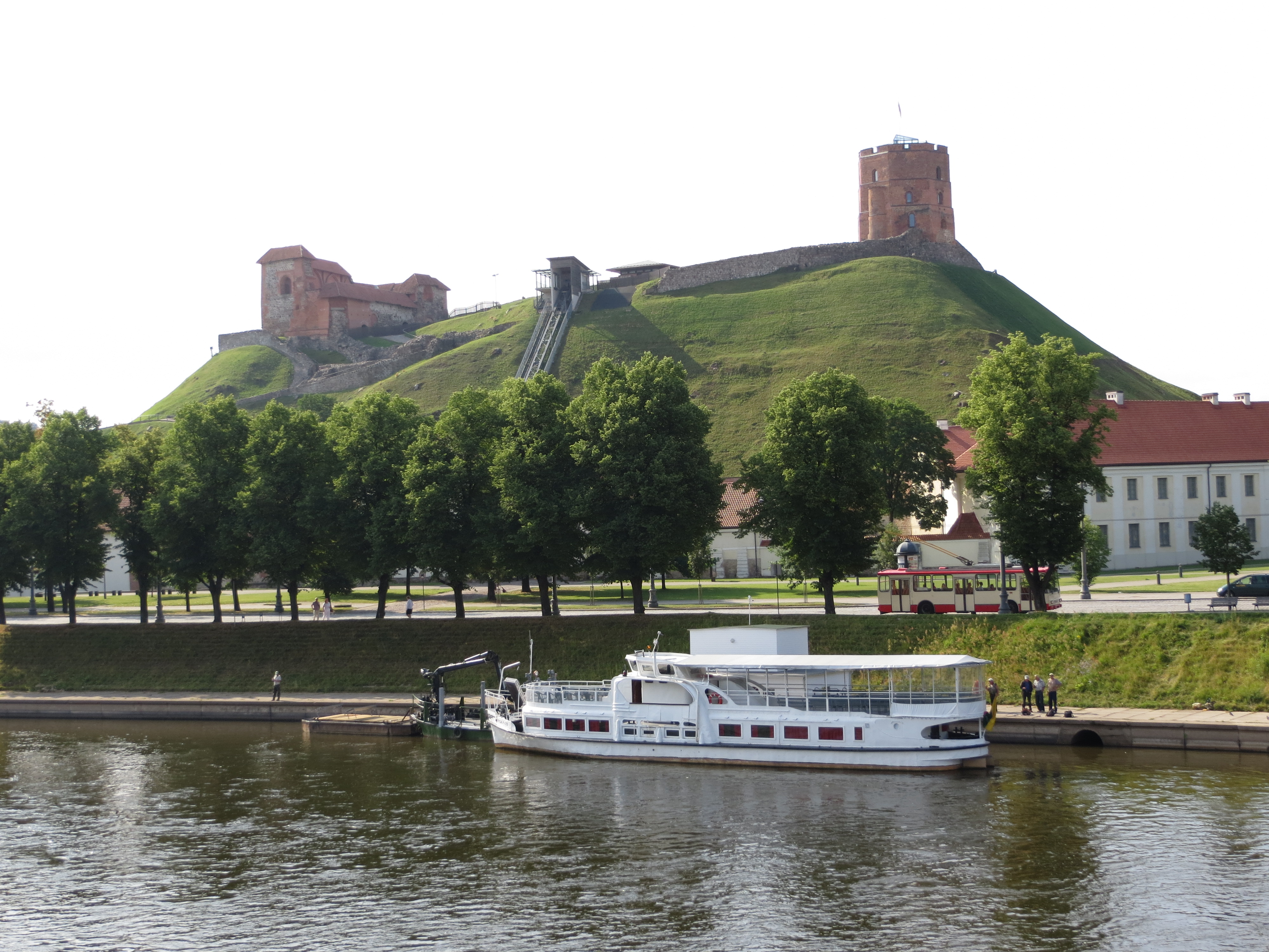
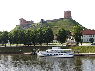
The Upper Castle in Vilnius, Lithuania, seen on Gediminas Hill across river Neris. Gediminas' Tower is the tall structure on the right while to the left (east) of the tower one can make out the ruins of the ducal palace. In 2003 a funicular to Gediminas' Hill opened up, it can be seen near the middle of the hill. |
| Date | Taken on 6 July 2013, 08:28 |
| Source | Upper Castle in Vilnius |
| Author | Bernt Rostad from Oslo, Norway |
| Camera location | | View this and other nearby images on: OpenStreetMap |
|---|
.jpg¶ms=054.689388_N_0025.288547_E_globe:Earth_type:camera_source:Flickr_&language=en)
Licensing
This file is licensed under the Creative Commons Attribution 2.0 Generic license.
- You are free:
- to share – to copy, distribute and transmit the work
- to remix – to adapt the work
- Under the following conditions:
- attribution – You must give appropriate credit, provide a link to the license, and indicate if changes were made. You may do so in any reasonable manner, but not in any way that suggests the licensor endorses you or your use.
| This image, originally posted to Flickr, was reviewed on 14 December 2013 by the administrator or reviewer File Upload Bot (Magnus Manske), who confirmed that it was available on Flickr under the stated license on that date. |
File history
Click on a date/time to view the file as it appeared at that time.
| Date/Time | Thumbnail | Dimensions | User | Comment | |
|---|---|---|---|---|---|
| current | 11:09, 14 December 2013 | | 4,000 × 3,000 (2.63 MB) | File Upload Bot (Magnus Manske) | Transferred from Flickr by User:GiW |
File usage
The following page uses this file:
.jpg)