
File:Torre del Oro, Guadalquivir, Sevilla.jpg

Size of this preview: 798 × 600 pixels. Other resolutions: 320 × 240 pixels | 3,842 × 2,887 pixels.
Original file (3,842 × 2,887 pixels, file size: 5.3 MB, MIME type: image/jpeg)
Summary
| Description |
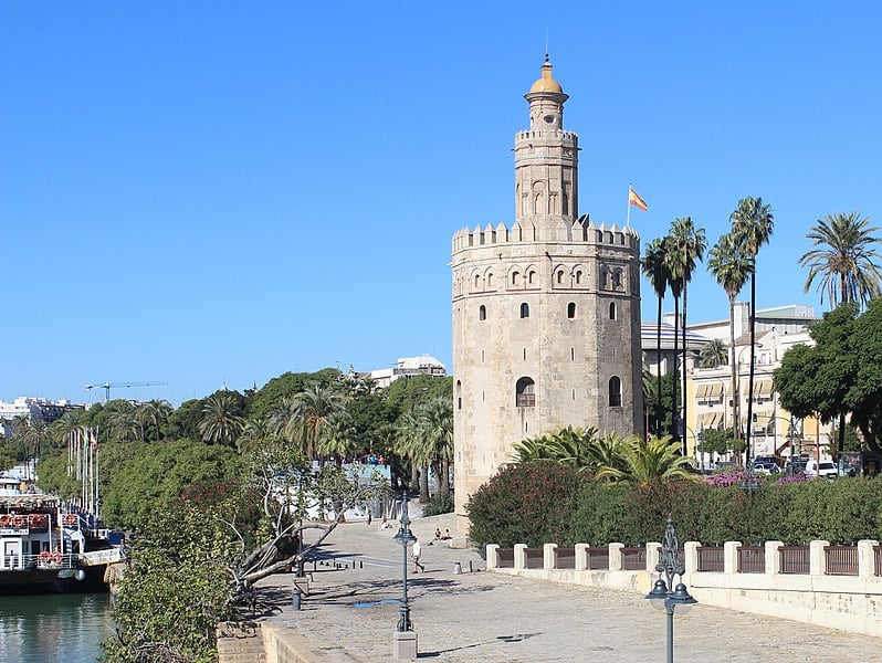
English: The Torre del Oro (Golden Tower) on the banks of the Guadalquivir, Seville taken from the Puente de San Telmo. Construction in the 13th century by the Almohad Caliphate to control access to Seville. The tower reached its present form in 1769. It is currently a museum.
Español: La Torre del Oro a orillas del Guadalquivir, Sevilla, tomada desde el Puente de San Telmo. Construcción en el siglo XIII por el Imperio almohade para controlar el acceso a Sevilla. La torre alcanzó su forma actual en 1769. Actualmente es un museo.
|
||||
| Date | |||||
| Source | Own work | ||||
| Author | Martinvl | ||||
| Other versions |
|
Licensing
I, the copyright holder of this work, hereby publish it under the following license:
This file is licensed under the Creative Commons Attribution-Share Alike 4.0 International license.
- You are free:
- to share – to copy, distribute and transmit the work
- to remix – to adapt the work
- Under the following conditions:
- attribution – You must give appropriate credit, provide a link to the license, and indicate if changes were made. You may do so in any reasonable manner, but not in any way that suggests the licensor endorses you or your use.
- share alike – If you remix, transform, or build upon the material, you must distribute your contributions under the same or compatible license as the original.
This image has been assessed using the Quality image guidelines and is considered a Quality image.
|
File history
Click on a date/time to view the file as it appeared at that time.
| Date/Time | Thumbnail | Dimensions | User | Comment | |
|---|---|---|---|---|---|
| current | 18:15, 13 November 2017 | | 3,842 × 2,887 (5.3 MB) | Martinvl | User created page with UploadWizard |
File usage
The following page uses this file: