File:The night view of Tokyo Narita Airport Terminal 1.JPG
Jump to: navigation, search
Size of this preview: 800 × 533 pixels. Other resolutions: 320 × 213 pixels | 6,000 × 4,000 pixels.
Original file (6,000 × 4,000 pixels, file size: 16.87 MB, MIME type: image/jpeg)
This file is from Wikimedia Commons and may be used by other projects. The description on its file description page there is shown below.
Summary
DescriptionThe night view of Tokyo Narita Airport Terminal 1.JPG |
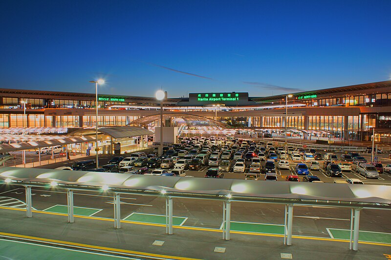
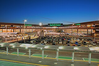
English: Narita Airport, Tokyo. |
Date | |
Source | Own work |
Author | Nanashinodensyaku |
Camera location | 35° 45′ 56.73″ N, 140° 23′ 13.43″ E | View this and other nearby images on: OpenStreetMap | 35.765759; 140.387064 |
---|
Licensing
I, the copyright holder of this work, hereby publish it under the following license:
This file is licensed under the Creative Commons Attribution-Share Alike 4.0 International license.
- You are free:
- to share – to copy, distribute and transmit the work
- to remix – to adapt the work
- Under the following conditions:
- attribution – You must give appropriate credit, provide a link to the license, and indicate if changes were made. You may do so in any reasonable manner, but not in any way that suggests the licensor endorses you or your use.
- share alike – If you remix, transform, or build upon the material, you must distribute your contributions under the same or compatible license as the original.
Items portrayed in this file
depicts
14 October 2014
35°45'56.732"N, 140°23'13.430"E
File history
Click on a date/time to view the file as it appeared at that time.
Date/Time | Thumbnail | Dimensions | User | Comment | |
---|---|---|---|---|---|
current | 15:30, 28 July 2015 | 6,000 × 4,000 (16.87 MB) | Denniss | Reverted to version as of 07:52, 20 December 2014 |
File usage
The following page uses this file:
Metadata
This file contains additional information, probably added from the digital camera or scanner used to create or digitize it.
If the file has been modified from its original state, some details may not fully reflect the modified file.
Image title | SONY DSC |
---|---|
Camera manufacturer | SONY |
Camera model | SLT-A77V |
Exposure time | 4/1 sec (4) |
F Number | f/16 |
ISO speed rating | 200 |
Date and time of data generation | 17:04, 19 December 2014 |
Lens focal length | 18 mm |
Latitude | 35° 45′ 56.73″ N |
Longitude | 140° 23′ 13.43″ E |
Altitude | 26.47 meters above sea level |
Orientation | Normal |
Horizontal resolution | 350 dpi |
Vertical resolution | 350 dpi |
Software used | Image Data Converter |
File change date and time | 21:17, 19 December 2014 |
Y and C positioning | Co-sited |
Exposure Program | Aperture priority |
Exif version | 2.3 |
Date and time of digitizing | 17:04, 19 December 2014 |
Meaning of each component |
|
Image compression mode | 8 |
APEX brightness | 0.01328125 |
APEX exposure bias | 1.5 |
Maximum land aperture | 3.6171875 APEX (f/3.5) |
Metering mode | Pattern |
Light source | Unknown |
Flash | Flash did not fire, compulsory flash suppression |
Supported Flashpix version | 0,100 |
Color space | sRGB |
Custom image processing | Normal process |
Exposure mode | Auto exposure |
White balance | Auto white balance |
Digital zoom ratio | 0 |
Focal length in 35 mm film | 27 mm |
Scene capture type | Standard |
Contrast | Normal |
Saturation | Normal |
Sharpness | Normal |
GPS time (atomic clock) | 08:04 |
Receiver status | Measurement in progress |
Measurement mode | 3-dimensional measurement |
Measurement precision | Poor (1.4126) |
Speed unit | Kilometers per hour |
Speed of GPS receiver | 0.012 |
Reference for direction of movement | True direction |
Direction of movement | 183.21 |
Geodetic survey data used | WGS-84 |
GPS date | 19 December 2014 |
GPS differential correction | 0 |
GPS tag version | 0.0.3.2 |