
File:The mouth of It River Yaroslavl region Russian Federation.jpg

Size of this preview: 800 × 534 pixels. Other resolutions: 320 × 214 pixels | 7,357 × 4,910 pixels.
Original file (7,357 × 4,910 pixels, file size: 25.34 MB, MIME type: image/jpeg)
Summary
| Description |
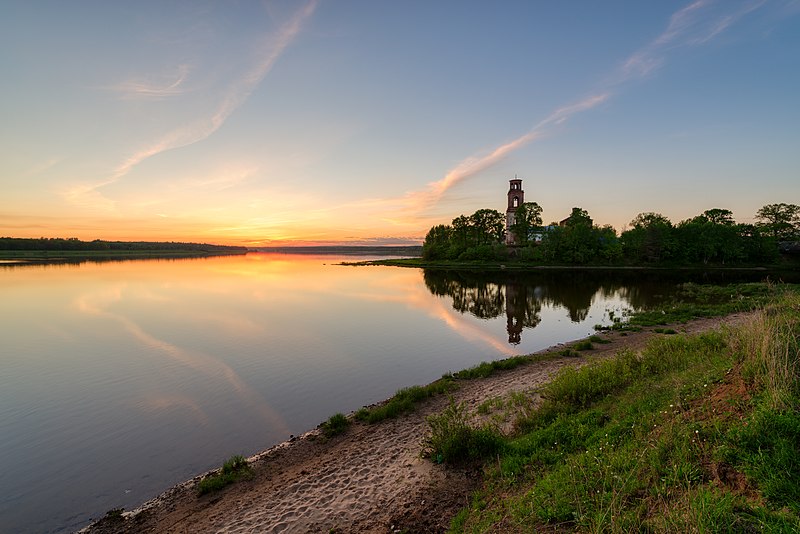
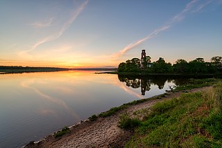
Русский: Вода отражает небо, а небо пытается отразить реку, рисуя в вышине облаками розовые берега.
Место впадения реки Ить в реку Волгу. Вид с юго-запада на северо-восток. Ить справа, Волга слева. Май. Тотчас после заката солнца. На противоположном берегу церковь Смоленской иконы Божией Матери, построенная в селе Устье в 1771 году. English: The water reflects the sky, while the sky tries to reflect the river, drawing on high with the pinky clouds the wobbly images of the darkening banks.
The confluence or Volga river (to the left) and It river (to the right). The view from south-west to north-east. Middle of may, just after the sunset. Yaroslavl region of Russian Federation. Italiano: L'acqua riflette il cielo, mentre il cielo cerca di riflettere il fiume, disegnando con nuvole rosa le immagini traballanti delle sponde che si oscurano.
Il fiume It. Maggio. Al'alba. Jaroslavl, Russia.
|
|||
| Date | Taken on 17 May 2019, 20:49:11 | |||
| Source | Own work | |||
| Author | Edward Kosarev |
| Camera location | | View this and other nearby images on: OpenStreetMap |
|---|
Licensing
I, the copyright holder of this work, hereby publish it under the following license:
This file is licensed under the Creative Commons Attribution-Share Alike 4.0 International license.
- You are free:
- to share – to copy, distribute and transmit the work
- to remix – to adapt the work
- Under the following conditions:
- attribution – You must give appropriate credit, provide a link to the license, and indicate if changes were made. You may do so in any reasonable manner, but not in any way that suggests the licensor endorses you or your use.
- share alike – If you remix, transform, or build upon the material, you must distribute your contributions under the same or compatible license as the original.
This image was uploaded as part of Wiki Loves Earth 2019.
|
 |
This image has been assessed using the Quality image guidelines and is considered a Quality image.
|
File history
Click on a date/time to view the file as it appeared at that time.
| Date/Time | Thumbnail | Dimensions | User | Comment | |
|---|---|---|---|---|---|
| current | 16:30, 21 May 2019 | | 7,357 × 4,910 (25.34 MB) | Stoxastikos | User created page with UploadWizard |
File usage
The following page uses this file: