File:Slottsskogen bro 01.jpg
Jump to: navigation, search
Size of this preview: 800 × 600 pixels. Other resolutions: 320 × 240 pixels | 4,896 × 3,672 pixels.
Original file (4,896 × 3,672 pixels, file size: 7.96 MB, MIME type: image/jpeg)
This file is from Wikimedia Commons and may be used by other projects. The description on its file description page there is shown below.
Summary
DescriptionSlottsskogen bro 01.jpg |
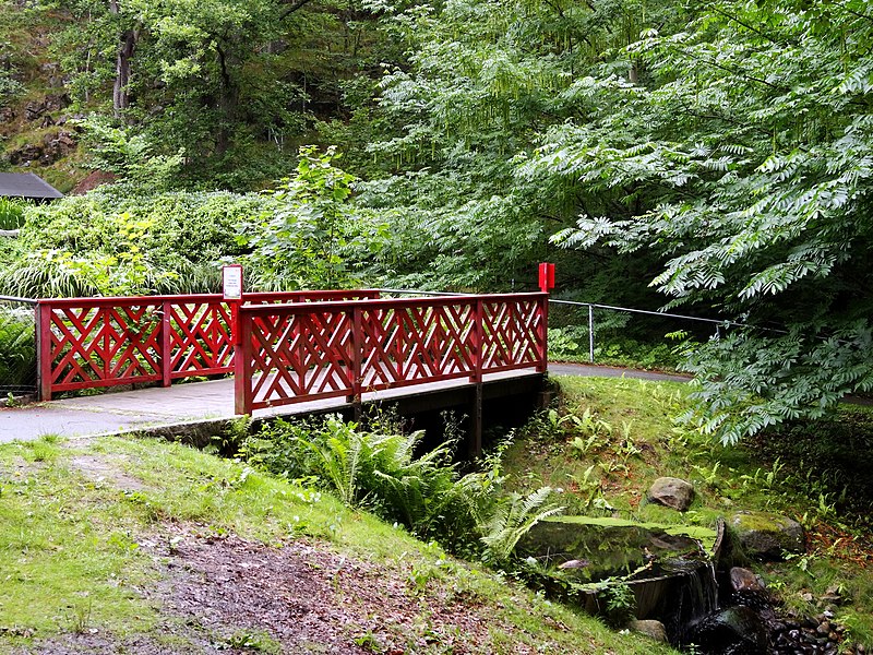
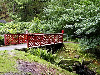
Svenska: En bro över vattendraget som förbinder Kobbska dammen och Alpdammen i Slottsskogen, Göteborg. |
Date | |
Source | Own work |
Author | Alicia Fagerving |
Camera location | 57° 41′ 03.23″ N, 11° 56′ 23.34″ E | View this and other nearby images on: OpenStreetMap | 57.684231; 11.939816 |
---|
Licensing
I, the copyright holder of this work, hereby publish it under the following license:
This file is licensed under the Creative Commons Attribution-Share Alike 3.0 Unported license.
- You are free:
- to share – to copy, distribute and transmit the work
- to remix – to adapt the work
- Under the following conditions:
- attribution – You must give appropriate credit, provide a link to the license, and indicate if changes were made. You may do so in any reasonable manner, but not in any way that suggests the licensor endorses you or your use.
- share alike – If you remix, transform, or build upon the material, you must distribute your contributions under the same or compatible license as the original.
Items portrayed in this file
depicts
some value
30 July 2017
57°41'3.232"N, 11°56'23.338"E
0.02 second
8.17 millimetre
125
image/jpeg
File history
Click on a date/time to view the file as it appeared at that time.
Date/Time | Thumbnail | Dimensions | User | Comment | |
---|---|---|---|---|---|
current | 06:56, 4 August 2017 | 4,896 × 3,672 (7.96 MB) | Vesihiisi | User created page with UploadWizard |
File usage
The following page uses this file:
Metadata
This file contains additional information, probably added from the digital camera or scanner used to create or digitize it.
If the file has been modified from its original state, some details may not fully reflect the modified file.
Camera manufacturer | SONY |
---|---|
Camera model | DSC-HX20V |
Exposure time | 1/50 sec (0.02) |
F Number | f/4 |
ISO speed rating | 125 |
Date and time of data generation | 16:36, 30 July 2017 |
Lens focal length | 8.17 mm |
Latitude | 57° 41′ 3.23″ N |
Longitude | 11° 56′ 23.34″ E |
Altitude | 32.1 meters above sea level |
Orientation | Normal |
Horizontal resolution | 350 dpi |
Vertical resolution | 350 dpi |
Software used | GIMP 2.8.18 |
File change date and time | 10:48, 31 July 2017 |
Y and C positioning | Co-sited |
Exposure Program | Normal program |
Exif version | 2.3 |
Date and time of digitizing | 16:36, 30 July 2017 |
Meaning of each component |
|
Image compression mode | 3 |
APEX brightness | 4.93125 |
APEX exposure bias | 0 |
Maximum land aperture | 4 APEX (f/4) |
Metering mode | Pattern |
Light source | Other light source |
Flash | Flash did not fire, compulsory flash suppression |
Supported Flashpix version | 0,100 |
Color space | sRGB |
File source | Digital still camera |
Scene type | A directly photographed image |
Custom image processing | Normal process |
Exposure mode | Auto exposure |
White balance | Manual white balance |
Digital zoom ratio | 1 |
Scene capture type | Standard |
Contrast | Normal |
Saturation | Normal |
Sharpness | Normal |
GPS time (atomic clock) | 15:36 |
Receiver status | Measurement in progress |
Measurement mode | 3-dimensional measurement |
Measurement precision | Poor (1.35) |
Speed unit | Kilometers per hour |
Speed of GPS receiver | 4.896 |
Reference for direction of movement | True direction |
Direction of movement | 21.77 |
Reference for direction of image | Magnetic direction |
Direction of image | 10.75 |
Geodetic survey data used | WGS-84 |
GPS date | 30 July 2017 |
GPS differential correction | 0 |
GPS tag version | 0.0.3.2 |
Image width | 4,896 px |
Image height | 3,672 px |
Retrieved from "https://hookuptravels.com/wiki/File:Slottsskogen_bro_01.jpg"