
File:RB BDhe 2-4 II Rigi Staffel - Rigi Kulm.jpg

Size of this preview: 800 × 494 pixels. Other resolutions: 320 × 198 pixels | 4,701 × 2,902 pixels.
Original file (4,701 × 2,902 pixels, file size: 3.35 MB, MIME type: image/jpeg)
Summary
| Description |
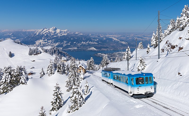
English: A Rigibahnen BDhe 2/4 II rack EMU pushes a cab car to Rigi Kulm in Central Switzerland on a morning with about 60 cm of fresh snow. In the background you can see Mount Pilatus.
Deutsch: Ein BDhe 2/4 II der Rigibahnen schiebt einen Steuerwagen auf die Rigi in der Zentralschweiz. Aufgenommen unterhalb von Rigi Kulm an einem Morgen mit etwa 60 cm Neuschnee. Im Hintergrund ist der Pilatus sichtbar. |
| Date | |
| Source | Own work: https://bahnbilder.ch/picture/25761 |
| Author | Kabelleger / David Gubler |
|
| Camera location | | View this and other nearby images on: OpenStreetMap |
|---|
Licensing
I, the copyright holder of this work, hereby publish it under the following license:
This file is licensed under the Creative Commons Attribution-Share Alike 4.0 International license.
- You are free:
- to share – to copy, distribute and transmit the work
- to remix – to adapt the work
- Under the following conditions:
- attribution – You must give appropriate credit, provide a link to the license, and indicate if changes were made. You may do so in any reasonable manner, but not in any way that suggests the licensor endorses you or your use.
- share alike – If you remix, transform, or build upon the material, you must distribute your contributions under the same or compatible license as the original.
| Annotations | This image is annotated: View the annotations at Commons |
File history
Click on a date/time to view the file as it appeared at that time.
| Date/Time | Thumbnail | Dimensions | User | Comment | |
|---|---|---|---|---|---|
| current | 20:03, 23 June 2017 | | 4,701 × 2,902 (3.35 MB) | Kabelleger | User created page with UploadWizard |
File usage
The following page uses this file: