
File:Pärnu kesklinn - Aerial photo of Pärnu in Estonia (2).jpg

Size of this preview: 800 × 428 pixels. Other resolutions: 320 × 171 pixels | 6,555 × 3,511 pixels.
Original file (6,555 × 3,511 pixels, file size: 7.94 MB, MIME type: image/jpeg)
Summary
| Description |
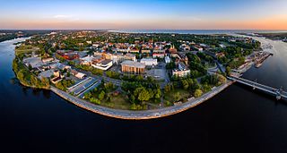
Eesti: Pärnu kesklinn
English: Aerial photo of Pärnu in Estonia
Русский: Вид с воздуха на Пярну, Эстония |
| Date | |
| Source | Own work |
| Author | Kristian Pikner |
| Other versions |
| Camera location | | View this and other nearby images on: OpenStreetMap |
|---|
.jpg¶ms=058.389167_N_0024.498611_E_globe:Earth_type:camera__&language=en)
Licensing
I, the copyright holder of this work, hereby publish it under the following license:
This file is licensed under the Creative Commons Attribution-Share Alike 4.0 International license.
- You are free:
- to share – to copy, distribute and transmit the work
- to remix – to adapt the work
- Under the following conditions:
- attribution – You must give appropriate credit, provide a link to the license, and indicate if changes were made. You may do so in any reasonable manner, but not in any way that suggests the licensor endorses you or your use.
- share alike – If you remix, transform, or build upon the material, you must distribute your contributions under the same or compatible license as the original.
This image was uploaded as part of Estonian HELP campaign 2016.
|
|
File history
Click on a date/time to view the file as it appeared at that time.
| Date/Time | Thumbnail | Dimensions | User | Comment | |
|---|---|---|---|---|---|
| current | 23:11, 5 December 2016 | | 6,555 × 3,511 (7.94 MB) | KristianPikner | Bigger photo |
File usage
The following page uses this file:
.jpg)