
File:Madlabantu Trail 03.jpg

Size of this preview: 800 × 533 pixels. Other resolutions: 320 × 213 pixels | 5,184 × 3,456 pixels.
Original file (5,184 × 3,456 pixels, file size: 5.96 MB, MIME type: image/jpeg)
Summary
| Description |
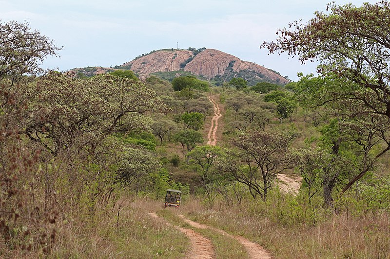
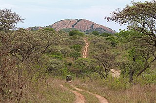
Afrikaans: 'n Safarivoertuig in Pretoriuskop-suurveld, hier op pad van Mtshawudam na Shabeniheuwel gesien, lg. sowat 3,4 km van die waarnemer af. Die maanhaarpaadjie maak deel uit van die Madlabantu-4x4-avontuurroete in die suidwestelike Krugerwildtuin, Mpumalanga, Suid-Afrika. Vaalbome (Terminalia sericea, Combretaceae) is op die voorgrond en verder padlangs sigbaar.
Acocks (1975) en Gertenbach het hierdie landskap as die Laeveldse suurbosveld (van Pretoriuskop) beskryf. Die hoogte bo seespieël wissel om die 600 meter en die jaarlikse neerslag is sowat 750 mm. Dit rus op Argaïese graniet en gneiss en vertoon onderskeibare kruine met rooi tot geelbruin grond, en dale met sanderige tot leemsanderige grond. Dit oorspan die waterskeiding tussen die Sabie- (via die Pabene- en Mtshawuspruite) aan die noordekant, en die Krokodilrivier (via die Nsikazi- en Mbyamidespruite) aan die suidekant. English: Looking over Pretoriuskop sourveld to the granite dome of Shabeni hill, from the Madlabantu Trail, southwestern Kruger Park, Mpumalanga, South Africa. The foreground trees with brown seed pods are silver cluster-leafs (Terminalia sericea, Combretaceae). The crest of the granite dome is 3.4 km (2.1 miles) distant.
Acocks (1975) and Gertenbach described this landscape as Lowveld Sour Bushveld (of Pretoriuskop). Its altitude varies around 600 metres a.s.l. and the annual precipitation around 750 mm per annum. It rests on Archain granite and gneiss and presents distinct uplands with red to yellow-brown soils, and bottomlands with sandy to sandy-loam soils. It spans the watershed which divides the Sabie River (via the Pabene and Mtshawu) to the north, and the Crocodile River (via the Nsikazi and Mbyamide) to the south. Français : Madlabantu Trail, parc Kruger, Afrique du Sud |
| Date | |
| Source | Own work |
| Author | Bernard Gagnon |
| Camera location | | View this and other nearby images on: OpenStreetMap |
|---|
Licensing
I, the copyright holder of this work, hereby publish it under the following licenses:

|
Permission is granted to copy, distribute and/or modify this document under the terms of the GNU Free Documentation License, Version 1.2 or any later version published by the Free Software Foundation; with no Invariant Sections, no Front-Cover Texts, and no Back-Cover Texts. A copy of the license is included in the section entitled GNU Free Documentation License. |
This file is licensed under the Creative Commons Attribution-Share Alike 4.0 International, 3.0 Unported, 2.5 Generic, 2.0 Generic and 1.0 Generic license.
- You are free:
- to share – to copy, distribute and transmit the work
- to remix – to adapt the work
- Under the following conditions:
- attribution – You must give appropriate credit, provide a link to the license, and indicate if changes were made. You may do so in any reasonable manner, but not in any way that suggests the licensor endorses you or your use.
- share alike – If you remix, transform, or build upon the material, you must distribute your contributions under the same or compatible license as the original.
You may select the license of your choice.
File history
Click on a date/time to view the file as it appeared at that time.
| Date/Time | Thumbnail | Dimensions | User | Comment | |
|---|---|---|---|---|---|
| current | 23:50, 17 October 2018 | | 5,184 × 3,456 (5.96 MB) | Bgag | {{Information |description ={{en|1=Madlabantu Trail, Kruger Park, South Africa}} {{fr|1=Madlabantu Trail, parc Kruger, Afrique du Sud}} |date =2017-11-15 |source ={{own}} |author =Bernard Gagnon }} {{Location|25|11|24.59|S|31|15|56.71|E}} Category:Madlabantu Trail |
File usage
The following page uses this file: