
File:MARSEILLE ST CHARLES (13741914473).jpg

Size of this preview: 800 × 600 pixels. Other resolutions: 320 × 240 pixels | 3,648 × 2,736 pixels.
Original file (3,648 × 2,736 pixels, file size: 2.1 MB, MIME type: image/jpeg)
Summary
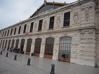
| Description | Construite en 1848 sous forme d'un corps de bâtiments en U autour d'une grande verrière, la gare surplombe la ville depuis le plateau Saint-Charles. |
| Date | |
| Source | MARSEILLE ST CHARLES |
| Author | patrick janicek from Courbevoie, France |
| Camera location | | View this and other nearby images on: OpenStreetMap |
|---|
.jpg¶ms=043.302851_N_0005.379674_E_globe:Earth_type:camera_source:Flickr_&language=en)
Licensing
This file is licensed under the Creative Commons Attribution 2.0 Generic license.
- You are free:
- to share – to copy, distribute and transmit the work
- to remix – to adapt the work
- Under the following conditions:
- attribution – You must give appropriate credit, provide a link to the license, and indicate if changes were made. You may do so in any reasonable manner, but not in any way that suggests the licensor endorses you or your use.
| This image was originally posted to Flickr by marsupilami92 at https://flickr.com/photos/41538865@N06/13741914473 (archive). It was reviewed on 18 May 2018 by FlickreviewR 2 and was confirmed to be licensed under the terms of the cc-by-2.0. |
File history
Click on a date/time to view the file as it appeared at that time.
| Date/Time | Thumbnail | Dimensions | User | Comment | |
|---|---|---|---|---|---|
| current | 13:15, 18 May 2018 | | 3,648 × 2,736 (2.1 MB) | OceanAtoll | Transferred from Flickr via #flickr2commons |
File usage
The following page uses this file:
.jpg)