
File:Lake Davos, Flüelatal and Dischmatal, picture taken from Dorfberg above Davos.jpg

Size of this preview: 800 × 600 pixels. Other resolutions: 320 × 240 pixels | 4,608 × 3,456 pixels.
Original file (4,608 × 3,456 pixels, file size: 3.52 MB, MIME type: image/jpeg)
Summary
| Description |
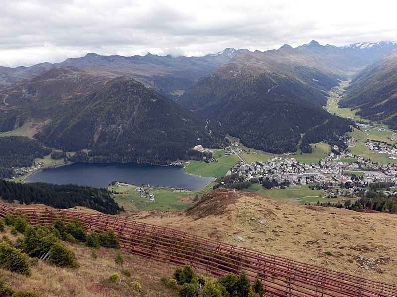
English: Lake Davos, Flüelatal and Dischmatal, picture taken from Dorfberg above Davos, Grison, Switzerland
Deutsch: Davosersee Flüelatal und Dischmatal, aufgenommen von Dorfberg über Davos, Graubünden, Schweiz
Rumantsch: Lai da Tavo, Val digl Flüela e Dischmatal, piglia se davent da Dorfberg sur Tavo, Grischun, Svizra
Italiano: Lago di Davos Flüelatal e Dischmatal, fotografato da Dorfberg sopra Davos, Grigioni, Svizzera |
|
| Date | ||
| Source | Own work | |
| Author | Capricorn4049 | |
| Permission (Reusing this file) |
|
| Camera location | | View this and other nearby images on: OpenStreetMap |
|---|
| Object location | | View this and other nearby images on: OpenStreetMap |
|---|
Licensing
This file is licensed under the Creative Commons Attribution-Share Alike 4.0 International license.
- You are free:
- to share – to copy, distribute and transmit the work
- to remix – to adapt the work
- Under the following conditions:
- attribution – You must give appropriate credit, provide a link to the license, and indicate if changes were made. You may do so in any reasonable manner, but not in any way that suggests the licensor endorses you or your use.
- share alike – If you remix, transform, or build upon the material, you must distribute your contributions under the same or compatible license as the original.
File history
Click on a date/time to view the file as it appeared at that time.
| Date/Time | Thumbnail | Dimensions | User | Comment | |
|---|---|---|---|---|---|
| current | 00:26, 20 October 2014 | | 4,608 × 3,456 (3.52 MB) | Capricorn4049 |
File usage
The following page uses this file: