File:L'illa roja, Pals.jpg
Original file (2,348 × 2,276 pixels, file size: 1.79 MB, MIME type: image/jpeg)
This file is from Wikimedia Commons and may be used by other projects. The description on its file description page there is shown below.
Summary
DescriptionL'illa roja, Pals.jpg |
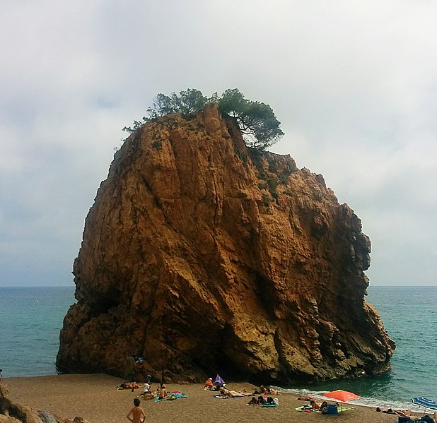
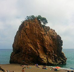
Español: Litoral del Baix Empordà
|
||
Date | |||
Source | Own work | ||
Author | Gas Mountain Team |
Camera location | 41° 58′ 37.08″ N, 3° 12′ 37.85″ E | View this and other nearby images on: OpenStreetMap | 41.976967; 3.210514 |
---|
Licensing
- You are free:
- to share – to copy, distribute and transmit the work
- to remix – to adapt the work
- Under the following conditions:
- attribution – You must give appropriate credit, provide a link to the license, and indicate if changes were made. You may do so in any reasonable manner, but not in any way that suggests the licensor endorses you or your use.
- share alike – If you remix, transform, or build upon the material, you must distribute your contributions under the same or compatible license as the original.
This image was uploaded as part of Wiki Loves Earth 2019.
aragonés | العربية | asturianu | azərbaycanca | беларуская (тарашкевіца) | български | বাংলা | brezhoneg | català | čeština | Cymraeg | Deutsch | Ελληνικά | English | español | eesti | euskara | فارسی | français | galego | עברית | hrvatski | հայերեն | Bahasa Indonesia | italiano | 日本語 | ქართული | 한국어 | latviešu | македонски | മലയാളം | मराठी | Bahasa Melayu | norsk bokmål | नेपाली | Nederlands | norsk | polski | português | português do Brasil | русский | sicilianu | shqip | slovenščina | српски / srpski | svenska | ไทย | Türkçe | українська | اردو | 中文 | 中文(台灣) | +/− |
Items portrayed in this file
depicts
41°58'37.081"N, 3°12'37.850"E
27 May 2017
0.000304307 second
2.4
3.97 millimetre
102
File history
Click on a date/time to view the file as it appeared at that time.
Date/Time | Thumbnail | Dimensions | User | Comment | |
---|---|---|---|---|---|
current | 17:03, 21 May 2019 | 2,348 × 2,276 (1.79 MB) | Gas Mountain Team | User created page with UploadWizard |
File usage
The following page uses this file:
Metadata
This file contains additional information, probably added from the digital camera or scanner used to create or digitize it.
If the file has been modified from its original state, some details may not fully reflect the modified file.
Camera model | Nexus 5 |
---|---|
Camera manufacturer | LGE |
F Number | f/2.4 |
Lens focal length | 3.97 mm |
Date and time of data generation | 11:46, 27 May 2017 |
ISO speed rating | 102 |
Exposure time | 304,307/1,000,000,000 sec (0.000304307) |
Longitude | 3° 12′ 37.85″ E |
Altitude | 52 meters above sea level |
Latitude | 41° 58′ 37.08″ N |
File change date and time | 15:43, 27 May 2017 |
Y and C positioning | Centered |
Vertical resolution | 72 dpi |
Orientation | 0 |
Software used | Aviary for Android 4.8.3 |
Horizontal resolution | 72 dpi |
Color space | sRGB |
Date and time of digitizing | 11:46, 27 May 2017 |
White balance | Auto white balance |
APEX aperture | 2.52 |
DateTime subseconds | 557,925 |
APEX shutter speed | -11.68 |
Meaning of each component |
|
DateTimeDigitized subseconds | 557,925 |
Flash | Flash did not fire |
Exif version | 2.2 |
Supported Flashpix version | 0,100 |
DateTimeOriginal subseconds | 557,925 |
GPS date | 27 May 2017 |
GPS time (atomic clock) | 09:46 |