File:Kaohsiung Taiwan Skyline 2019.jpg
Jump to: navigation, search
Size of this preview: 799 × 600 pixels. Other resolutions: 320 × 240 pixels | 3,772 × 2,832 pixels.
Original file (3,772 × 2,832 pixels, file size: 1.98 MB, MIME type: image/jpeg)
This file is from Wikimedia Commons and may be used by other projects. The description on its file description page there is shown below.
Summary
DescriptionKaohsiung Taiwan Skyline 2019.jpg |
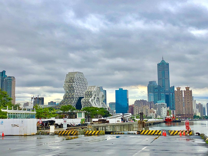
English: Skyline of Kaohsiung, Taiwan in 2019
中文(繁體):中華民國台灣高雄天際線(攝於2019年) |
Date | |
Source | Kaohsiung skyline 2019 |
Author | 毛貓大少爺 |
Camera location | 22° 37′ 06.45″ N, 120° 16′ 59.83″ E | View this and other nearby images on: OpenStreetMap | 22.618458; 120.283286 |
---|
Licensing
This image was originally posted to Flickr by 毛貓大少爺 at https://flickr.com/photos/92975612@N02/48580863177 (archive). It was reviewed on 31 August 2019 by FlickreviewR 2 and was confirmed to be licensed under the terms of the cc-by-sa-2.0. |
31 August 2019
This file is licensed under the Creative Commons Attribution-Share Alike 2.0 Generic license.
- You are free:
- to share – to copy, distribute and transmit the work
- to remix – to adapt the work
- Under the following conditions:
- attribution – You must give appropriate credit, provide a link to the license, and indicate if changes were made. You may do so in any reasonable manner, but not in any way that suggests the licensor endorses you or your use.
- share alike – If you remix, transform, or build upon the material, you must distribute your contributions under the same or compatible license as the original.
Items portrayed in this file
depicts
19 August 2019
22°37'6.449"N, 120°16'59.830"E
0.0017301038062283737 second
1.8
3.99 millimetre
image/jpeg
File history
Click on a date/time to view the file as it appeared at that time.
Date/Time | Thumbnail | Dimensions | User | Comment | |
---|---|---|---|---|---|
current | 01:14, 31 August 2019 | 3,772 × 2,832 (1.98 MB) | Heeheemalu | User created page with UploadWizard |
File usage
The following page uses this file:
Metadata
This file contains additional information, probably added from the digital camera or scanner used to create or digitize it.
If the file has been modified from its original state, some details may not fully reflect the modified file.
Camera manufacturer | Apple |
---|---|
Camera model | iPhone 8 Plus |
Exposure time | 1/578 sec (0.0017301038062284) |
F Number | f/1.8 |
ISO speed rating | 20 |
Date and time of data generation | 15:57, 19 August 2019 |
Lens focal length | 3.99 mm |
Latitude | 22° 37′ 6.45″ N |
Longitude | 120° 16′ 59.83″ E |
Altitude | 5.945 meters above sea level |
Horizontal resolution | 72 dpi |
Vertical resolution | 72 dpi |
Software used | 12.4 |
File change date and time | 15:57, 19 August 2019 |
Exposure Program | Normal program |
Exif version | 2.21 |
Date and time of digitizing | 15:57, 19 August 2019 |
Meaning of each component |
|
APEX shutter speed | 9.1750122488976 |
APEX aperture | 1.6959938128384 |
APEX brightness | 8.6751621173277 |
APEX exposure bias | 0 |
Metering mode | Spot |
Flash | Flash did not fire, auto mode |
DateTimeOriginal subseconds | 922 |
DateTimeDigitized subseconds | 922 |
Supported Flashpix version | 0,100 |
Sensing method | One-chip color area sensor |
Scene type | A directly photographed image |
Exposure mode | Auto exposure |
White balance | Auto white balance |
Digital zoom ratio | 1.7601862630966 |
Focal length in 35 mm film | 49 mm |
Scene capture type | Standard |
GPS time (atomic clock) | 07:57 |
Speed unit | Kilometers per hour |
Speed of GPS receiver | 0.2037665248052 |
Reference for direction of image | True direction |
Direction of image | 104.95218855219 |
Reference for bearing of destination | True direction |
Bearing of destination | 104.95218855219 |
GPS date | 19 August 2019 |