File:Gr-20-asco-tighiettu-11.jpg
Jump to: navigation, search
Size of this preview: 800 × 301 pixels. Other resolution: 320 × 120 pixels.
Original file (2,848 × 1,072 pixels, file size: 1.7 MB, MIME type: image/jpeg)
This file is from Wikimedia Commons and may be used by other projects. The description on its file description page there is shown below.
Summary
DescriptionGr-20-asco-tighiettu-11.jpg |
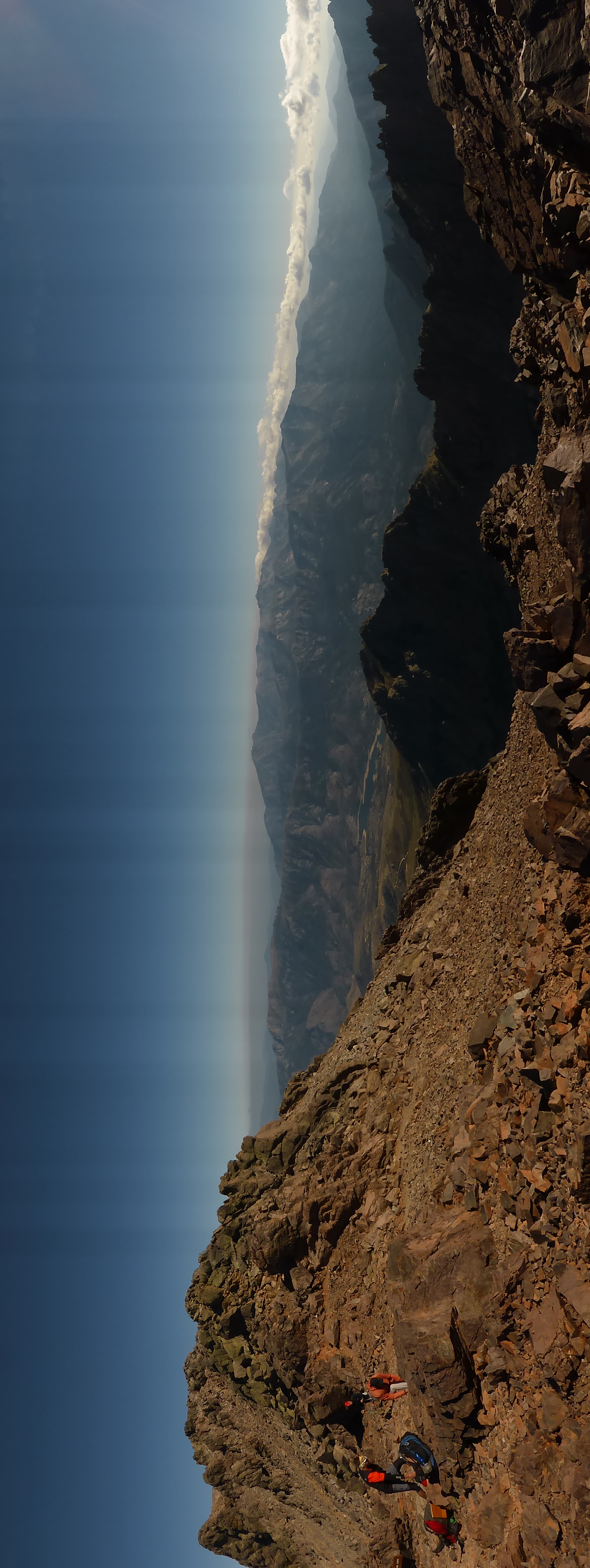
Deutsch: GR 20 zwischen Asco und Tighiettu |
Date | |
Source | Own work |
Author | MartinThoma |
Camera location | 42° 22′ 34.61″ N, 8° 56′ 14.8″ E | View this and other nearby images on: OpenStreetMap | 42.376281; 8.937444 |
---|
Licensing
I, the copyright holder of this work, hereby publish it under the following license:
This file is made available under the Creative Commons CC0 1.0 Universal Public Domain Dedication. | |
The person who associated a work with this deed has dedicated the work to the public domain by waiving all of their rights to the work worldwide under copyright law, including all related and neighboring rights, to the extent allowed by law. You can copy, modify, distribute and perform the work, even for commercial purposes, all without asking permission.
http://creativecommons.org/publicdomain/zero/1.0/deed.enCC0Creative Commons Zero, Public Domain Dedicationfalsefalse |
Items portrayed in this file
depicts
29 September 2016
42°22'34.612"N, 8°56'14.798"E
File history
Click on a date/time to view the file as it appeared at that time.
Date/Time | Thumbnail | Dimensions | User | Comment | |
---|---|---|---|---|---|
current | 08:25, 10 October 2016 | 2,848 × 1,072 (1.7 MB) | MartinThoma | User created page with UploadWizard |
File usage
The following page uses this file:
Metadata
This file contains additional information, probably added from the digital camera or scanner used to create or digitize it.
If the file has been modified from its original state, some details may not fully reflect the modified file.
Camera manufacturer | Panasonic |
---|---|
Camera model | DMC-TZ41 |
Exposure time | 1/800 sec (0.00125) |
F Number | f/6.3 |
ISO speed rating | 100 |
Date and time of data generation | 15:22, 29 September 2016 |
Lens focal length | 4.3 mm |
Latitude | 42° 22′ 34.61″ N |
Longitude | 8° 56′ 14.8″ E |
Altitude | 0 meters above sea level |
Orientation | Rotated 90° CCW |
Horizontal resolution | 180 dpi |
Vertical resolution | 180 dpi |
Software used | Ver.1.2 |
File change date and time | 15:22, 29 September 2016 |
Y and C positioning | Co-sited |
Exposure Program | Normal program |
Exif version | 2.3 |
Date and time of digitizing | 15:22, 29 September 2016 |
Meaning of each component |
|
Image compression mode | 4 |
APEX exposure bias | -1.33 |
Maximum land aperture | 3.4453125 APEX (f/3.3) |
Metering mode | Pattern |
Light source | Shade |
Flash | Flash did not fire, compulsory flash suppression |
Supported Flashpix version | 0,100 |
Color space | sRGB |
Sensing method | One-chip color area sensor |
File source | Digital still camera |
Scene type | A directly photographed image |
Custom image processing | Normal process |
Exposure mode | Auto exposure |
White balance | Manual white balance |
Digital zoom ratio | 0 |
Focal length in 35 mm film | 24 mm |
Scene capture type | Standard |
Scene control | None |
Contrast | Normal |
Saturation | Normal |
Sharpness | Normal |
GPS time (atomic clock) | 13:22 |
Receiver status | Measurement in progress |
Measurement mode | 2-dimensional measurement |
Measurement precision | Moderate (1) |
Reference for direction of image | True direction |
Direction of image | 112.5 |
Geodetic survey data used | WGS-84 |
Name of GPS area | --- |
GPS date | 29 September 2016 |
GPS tag version | 0.0.3.2 |
Retrieved from "https://hookuptravels.com/wiki/File:Gr-20-asco-tighiettu-11.jpg"