File:Esenboğa International Airport 3.jpg
Jump to: navigation, search
Size of this preview: 800 × 450 pixels. Other resolutions: 320 × 180 pixels | 2,310 × 1,300 pixels.
Original file (2,310 × 1,300 pixels, file size: 1.38 MB, MIME type: image/jpeg)
This file is from Wikimedia Commons and may be used by other projects. The description on its file description page there is shown below.
Summary
DescriptionEsenboğa International Airport 3.jpg |
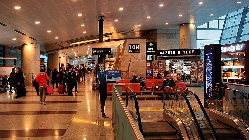
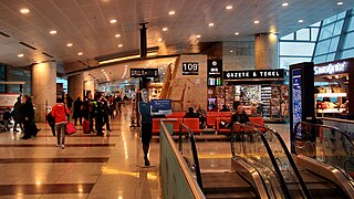
English: Ankara Esenboğa International Airport
Türkçe: Ankara Esenboğa Uluslararası Havalimanı |
Date | |
Source | https://www.flickr.com/photos/franganillo/24142594542/in/album-72157653822670521/ |
Author | https://www.flickr.com/photos/franganillo/ |
Camera location | 40° 06′ 54.08″ N, 32° 59′ 27.47″ E | View this and other nearby images on: OpenStreetMap | 40.115021; 32.990964 |
---|
Licensing
This image was originally posted to Flickr by Jorge Franganillo at https://flickr.com/photos/46191841@N00/24142594542. It was reviewed on 12 August 2016 by FlickreviewR and was confirmed to be licensed under the terms of the cc-by-2.0. |
12 August 2016
This file is licensed under the Creative Commons Attribution 2.0 Generic license.
- You are free:
- to share – to copy, distribute and transmit the work
- to remix – to adapt the work
- Under the following conditions:
- attribution – You must give appropriate credit, provide a link to the license, and indicate if changes were made. You may do so in any reasonable manner, but not in any way that suggests the licensor endorses you or your use.
Items portrayed in this file
depicts
4 January 2016
40°6'54.076"N, 32°59'27.470"E
0.07692307692307692307 second
24 millimetre
200
image/jpeg
File history
Click on a date/time to view the file as it appeared at that time.
Date/Time | Thumbnail | Dimensions | User | Comment | |
---|---|---|---|---|---|
current | 18:56, 12 August 2016 | 2,310 × 1,300 (1.38 MB) | Lpxl | User created page with UploadWizard |
File usage
The following page uses this file:
Metadata
This file contains additional information, probably added from the digital camera or scanner used to create or digitize it.
If the file has been modified from its original state, some details may not fully reflect the modified file.
Camera manufacturer | Canon |
---|---|
Camera model | Canon EOS 400D DIGITAL |
Date and time of data generation | 07:26, 4 January 2016 |
Exposure time | 1/13 sec (0.076923076923077) |
F Number | f/4 |
ISO speed rating | 200 |
Lens focal length | 24 mm |
Latitude | 40° 6′ 54.08″ N |
Longitude | 32° 59′ 27.47″ E |
Author | Ankara Esenboğa Airport |
Horizontal resolution | 72 dpi |
Vertical resolution | 72 dpi |
Orientation | Normal |
File change date and time | 07:26, 4 January 2016 |
Software used | PaintShop Pro 14,00 |
Exif version | 2.21 |
Supported Flashpix version | 0,100 |
Color space | sRGB |
Meaning of each component |
|
Date and time of digitizing | 07:26, 4 January 2016 |
Exposure Program | Aperture priority |
APEX shutter speed | 3.700439453125 |
APEX aperture | 4 |
APEX exposure bias | 0.33333333333333 |
Metering mode | Pattern |
Flash | Flash did not fire, compulsory flash suppression |
Focal plane X resolution | 4,433.2953249715 |
Focal plane Y resolution | 4,453.6082474227 |
Focal plane resolution unit | inches |
Custom image processing | Normal process |
Exposure mode | Auto exposure |
White balance | Manual white balance |
Scene capture type | Standard |
GPS time (atomic clock) | 06:26 |
Geodetic survey data used | WGS-84 |
GPS date | 4 January 2016 |
GPS tag version | 0.0.2.2 |
Supported Flashpix version | 1 |
Image width | 3,888 px |
Image height | 2,592 px |
Compression scheme | JPEG (old) |
Y and C positioning | Co-sited |
Height | 2,124 px |
Width | 3,776 px |