
File:Commercial harbour at dusk (9451886137).jpg

Original file (4,288 × 2,848 pixels, file size: 3.04 MB, MIME type: image/jpeg)
Summary
| Description |
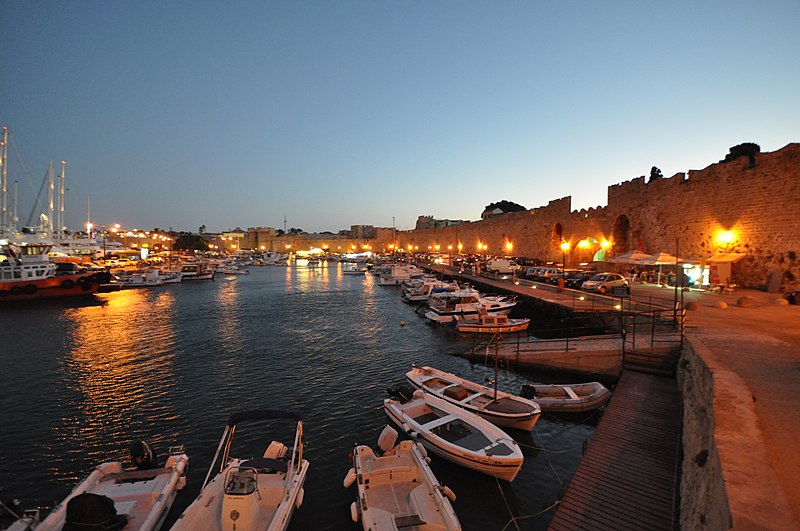
English: Rhodes is closer to Asia Minor than to the Greek mainland.
The island of Rhodes is shaped like a spearhead, 79.7 km (49.5 mi) long and 38 km (24 mi) wide, with a total area of approximately 1,400 square kilometres (541 sq mi) and a coastline of approximately 220 km (137 mi). The city of Rhodes is located at the northern tip of the island, as well as the site of the ancient and modern commercial harbours. The main air gateway (Diagoras International Airport, IATA code: RHO) is located 14 km (9 mi) to the southwest of the city in Paradisi. The road network radiates from the city along the east and west coasts. Outside of the city of Rhodes, the island is dotted with small villages and beach resorts, among them Faliraki, Lindos, Kremasti, Haraki, Pefkos, Archangelos, Afantou, Koskinou, Embona (Attavyros), Paradisi, and Trianta (Ialysos). It is situated 363 km (226 mi) east-south-east from Greece mainland and only 18 km (11 mi) from the southern shore of Turkey [Wikipedia.org] |
| Date | |
| Source | Commercial harbour at dusk |
| Author | Jorge Láscar from Australia |
| Camera location | | View this and other nearby images on: OpenStreetMap |
|---|
.jpg¶ms=036.446417_N_0028.228721_E_globe:Earth_type:camera_source:Flickr_&language=en)
Licensing
- You are free:
- to share – to copy, distribute and transmit the work
- to remix – to adapt the work
- Under the following conditions:
- attribution – You must give appropriate credit, provide a link to the license, and indicate if changes were made. You may do so in any reasonable manner, but not in any way that suggests the licensor endorses you or your use.
| This image was originally posted to Flickr by Jorge Lascar at https://www.flickr.com/photos/8721758@N06/9451886137. It was reviewed on 2 April 2014 by FlickreviewR and was confirmed to be licensed under the terms of the cc-by-2.0. |
File history
Click on a date/time to view the file as it appeared at that time.
| Date/Time | Thumbnail | Dimensions | User | Comment | |
|---|---|---|---|---|---|
| current | 06:37, 2 April 2014 | | 4,288 × 2,848 (3.04 MB) | Russavia | Transferred from Flickr |
File usage
The following page uses this file:
.jpg)