
File:CAR regions map.png

Size of this preview: 800 × 574 pixels. Other resolutions: 320 × 230 pixels | 3,008 × 2,159 pixels.
Original file (3,008 × 2,159 pixels, file size: 1.78 MB, MIME type: image/png)
Summary
| Description |
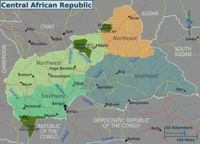
English: Central African Republic regions map. English version, Central African Republic
|
||||
| Date | |||||
| Source |
|
||||
| Author | Peter Fitzgerald |

|
File:CAR regions map.svg is a vector version of this file. It should be used in place of this PNG file when not inferior.
File:CAR regions map.png → File:CAR regions map.svg
For more information, see Help:SVG. |
 |
Licensing
This file is licensed under the Creative Commons Attribution 3.0 Unported license.
- You are free:
- to share – to copy, distribute and transmit the work
- to remix – to adapt the work
- Under the following conditions:
- attribution – You must give appropriate credit, provide a link to the license, and indicate if changes were made. You may do so in any reasonable manner, but not in any way that suggests the licensor endorses you or your use.
Original upload log
| This file was imported from Wikivoyage WTS. |
The original description page was here. All following user names refer to wts.wikivoyage-old.
- 2010-01-25 20:57 (WT-shared) Peterfitzgerald archive copy at the Wayback Machine 3008×2159 (1835951 bytes) == Summary == {{Imagecredit|credit=Peter Fitzgerald|captureDate=25 January 2010|location=Central African Republic|source=[[:Image:Central Af (Import from wikitravel.org/shared)
- 2011-07-22 23:11 (WT-shared) Peterfitzgerald archive copy at the Wayback Machine 3008×2159 (1861841 bytes) split off S Sudan (Import from wikitravel.org/shared)
File history
Click on a date/time to view the file as it appeared at that time.
| Date/Time | Thumbnail | Dimensions | User | Comment | |
|---|---|---|---|---|---|
| current | 06:34, 22 November 2012 | | 3,008 × 2,159 (1.78 MB) | OgreBot | (BOT): Reverting to most recent version before archival |
File usage
The following page uses this file: