File:Agglo'bus cayenne n°3 de la RCT.jpg
Jump to: navigation, search
Size of this preview: 800 × 480 pixels. Other resolutions: 320 × 192 pixels | 1,280 × 768 pixels.
Original file (1,280 × 768 pixels, file size: 476 KB, MIME type: image/jpeg)
This file is from Wikimedia Commons and may be used by other projects. The description on its file description page there is shown below.
Summary
DescriptionAgglo'bus cayenne n°3 de la RCT.jpg |
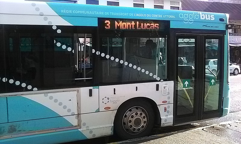
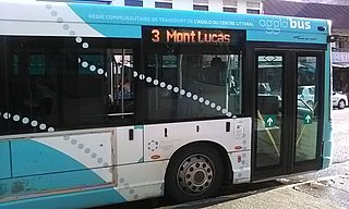
Français : Un bus de l'agglo, transport public, dans la ville de Cayenne, Guyane Française, en mai 2016.
English: A bus from chipboard, public transport, in the city of Cayenne, French Guiana, May 2016.
Português: Um ônibus de aglomerado, transportes públicos, na cidade de Caiena, Guiana Francesa, Maio de 2016. |
Date | |
Source | Own work |
Author | Tonnegrande |
Camera location | 4° 56′ 09.57″ N, 52° 20′ 02.53″ W | View this and other nearby images on: OpenStreetMap | 4.935992; -52.334036 |
---|
Licensing
I, the copyright holder of this work, hereby publish it under the following license:
This file is licensed under the Creative Commons Attribution-Share Alike 4.0 International license.
- You are free:
- to share – to copy, distribute and transmit the work
- to remix – to adapt the work
- Under the following conditions:
- attribution – You must give appropriate credit, provide a link to the license, and indicate if changes were made. You may do so in any reasonable manner, but not in any way that suggests the licensor endorses you or your use.
- share alike – If you remix, transform, or build upon the material, you must distribute your contributions under the same or compatible license as the original.
Items portrayed in this file
depicts
31 May 2016
4°56'9.5722000001"N, 52°20'2.5288000008"W
image/jpeg
844e5a03c92cf4e599c6dc2dfc7d4ffa2fe8bf11
487,078 byte
768 pixel
1,280 pixel
File history
Click on a date/time to view the file as it appeared at that time.
Date/Time | Thumbnail | Dimensions | User | Comment | |
---|---|---|---|---|---|
current | 00:31, 18 July 2016 | 1,280 × 768 (476 KB) | Tonnegrande | User created page with UploadWizard |
File usage
The following page uses this file:
Metadata
This file contains additional information, probably added from the digital camera or scanner used to create or digitize it.
If the file has been modified from its original state, some details may not fully reflect the modified file.
Camera model | AC50EHE |
---|---|
Camera manufacturer | Archos |
Lens focal length | 3.16 mm |
Date and time of data generation | 07:49, 31 May 2016 |
ISO speed rating | 100 |
Exposure time | 1/239 sec (0.00418410041841) |
Longitude | 52° 20′ 2.53″ W |
Altitude | 16 meters above sea level |
Latitude | 4° 56′ 9.57″ N |
File change date and time | 07:49, 31 May 2016 |
Y and C positioning | Centered |
Vertical resolution | 72 dpi |
Horizontal resolution | 72 dpi |
Color space | sRGB |
Date and time of digitizing | 07:49, 31 May 2016 |
APEX aperture | 2.4 |
Exposure mode | Auto exposure |
DateTimeDigitized subseconds | 979,376 |
Focal length in 35 mm film | 0 mm |
Scene capture type | Standard |
Scene type | A directly photographed image |
DateTimeOriginal subseconds | 979,376 |
Exposure index | 89 |
Exposure Program | Not defined |
DateTime subseconds | 979,376 |
APEX shutter speed | 7.903 |
Metering mode | Average |
Scene control | Low gain up |
Meaning of each component |
|
Flash | Flash did not fire, auto mode |
Exif version | 2.2 |
APEX brightness | 5.55 |
Sensing method | 0 |
Supported Flashpix version | 0,100 |
GPS date | 31 May 2016 |
Direction of image | 0 |
Reference for direction of image | Magnetic direction |
GPS time (atomic clock) | 10:49 |