
File:2013-10-03 View from Rozafa Castle, Shkodër 0271.jpg

Size of this preview: 800 × 533 pixels. Other resolutions: 320 × 213 pixels | 5,343 × 3,561 pixels.
Original file (5,343 × 3,561 pixels, file size: 9.94 MB, MIME type: image/jpeg)
Summary
| Description |
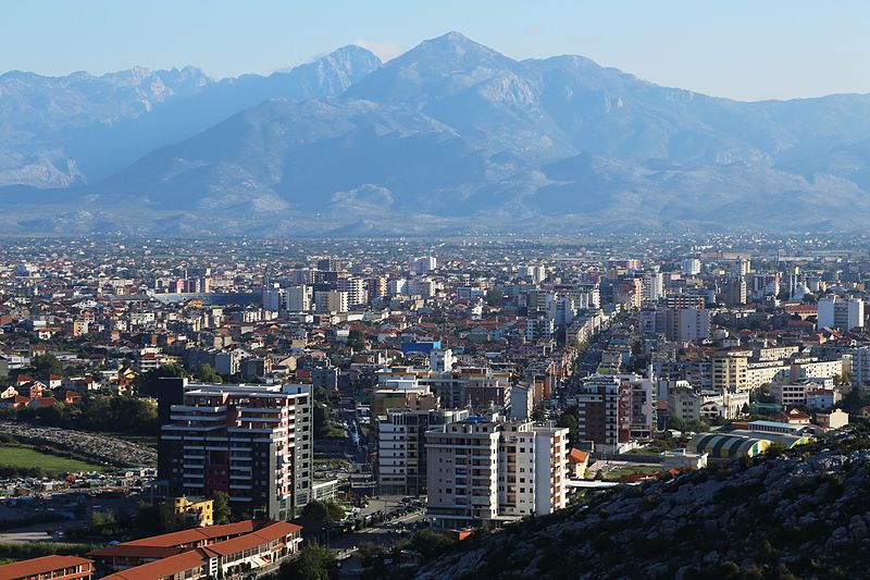
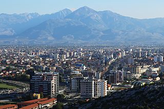
English: View from Rozafa Castle in Albania |
| Date | |
| Source | Own work |
| Author |
Tobias Klenze Deutsch: Weiterverwendung gemäß Lizenz mit dem folgenden Hinweis möglich:
Bild: Wikipedia / Tobias Klenze / CC-BY-SA 4.0. Die Lizenz muss verlinkt werden!English: You may re-use this image under the terms of the license using the following reference: Image: Wikipedia / Tobias Klenze / CC-BY-SA 4.0. The license must be a link! |
| Camera location | | View this and other nearby images on: OpenStreetMap |
|---|
Licensing
I, the copyright holder of this work, hereby publish it under the following licenses:

|
Permission is granted to copy, distribute and/or modify this document under the terms of the GNU Free Documentation License, Version 1.2 or any later version published by the Free Software Foundation; with no Invariant Sections, no Front-Cover Texts, and no Back-Cover Texts. A copy of the license is included in the section entitled GNU Free Documentation License. |
This file is licensed under the Creative Commons Attribution 3.0 Unported license.
- You are free:
- to share – to copy, distribute and transmit the work
- to remix – to adapt the work
- Under the following conditions:
- attribution – You must give appropriate credit, provide a link to the license, and indicate if changes were made. You may do so in any reasonable manner, but not in any way that suggests the licensor endorses you or your use.
You may select the license of your choice.
| Annotations | This image is annotated: View the annotations at Commons |
File history
Click on a date/time to view the file as it appeared at that time.
| Date/Time | Thumbnail | Dimensions | User | Comment | |
|---|---|---|---|---|---|
| current | 11:56, 19 December 2013 | | 5,343 × 3,561 (9.94 MB) | Church of emacs |
File usage
The following page uses this file: